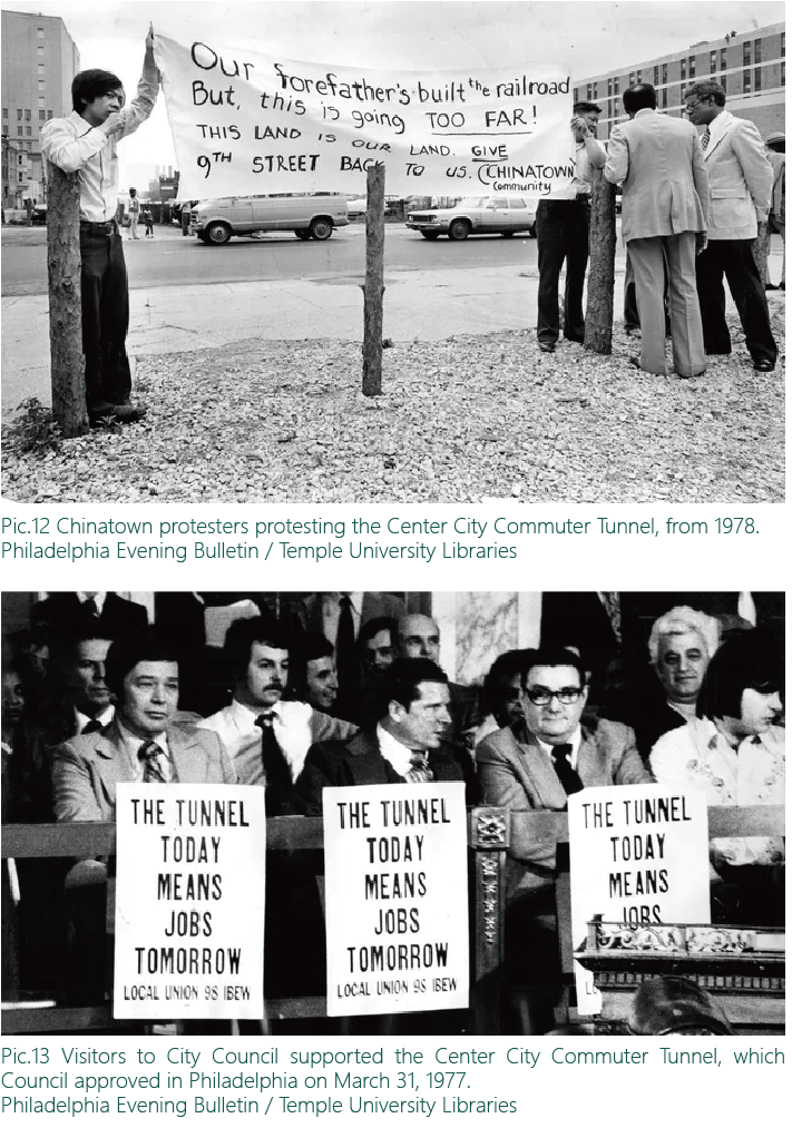
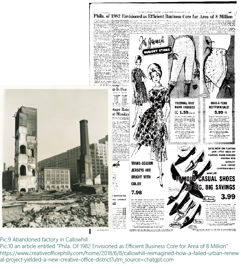
Why do we need the Chinatown Stitch Project?
Construction of the I-676 split the neighborhood into Chinatown and Callowhill which lead to problems such as rising housing costs, low land use efficiency, and highway barrier effects in the neighborhoods.
Scroll to Explore
timeline

Chinatown

Philadelphia’s Chinatown was established in the mid-19th century by Chinese immigrants fleeing discrimination on the West Coast. Over time, it grew into a vibrant hub of businesses, cultural institutions, and community life. Despite facing threats from urban renewal and highway construction, Chinatown has remained resilient.

Today, however, rising rent prices are putting pressure on long-time residents and small businesses, threatening the neighborhood’s cultural identity.

Map of I-676

Callowhill

North of Chinatown, Callowhill developed as an industrial district in the 19th and early 20th centuries. With deindustrialization, the area declined, leaving behind abandoned factories and warehouses.

In recent decades, parts of Callowhill have been revived through loft conversions and creative redevelopment, but large pockets of underused land, especially near Vine Street, remain a persistent issue.

Map of I-676

Vine Street

Vine Street evolved from a major city road into the Vine Street Expressway (I-676) during the 1960s. The construction cut through the area, displacing families and businesses and permanently dividing the neighborhoods. The expressway remains a major barrier to connectivity and community cohesion across the area.

Map of I-676

Over the decades, Philadelphia’s Chinatown, Callowhill, and Vine Street areas have been shaped by waves of immigration, urban renewal, and major infrastructure development.

Today, the neighborhood faces three major challenges:

Map of I-676

The Chinatown Stitch Project aims to address these challenges and create a healthier, more connected, and more livable neighborhood for its residents.

NEXT