10th St. Plaza over I-676
What is the Chinatown Stitch going to do?
Understanding the potential impacts of the Chinatown Stitch.
1. What is the Chinatown Stitch?
2. What effects do highway caps have in other cities?
3. How are we predicting the potential impact of the Chinatown Stitch?
Scroll to Explore

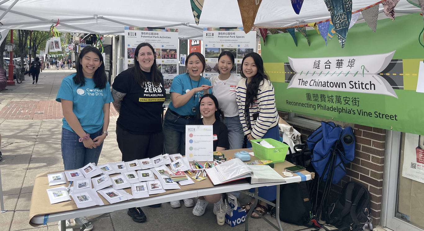
1. The Chinatown Stitch

Project Summary

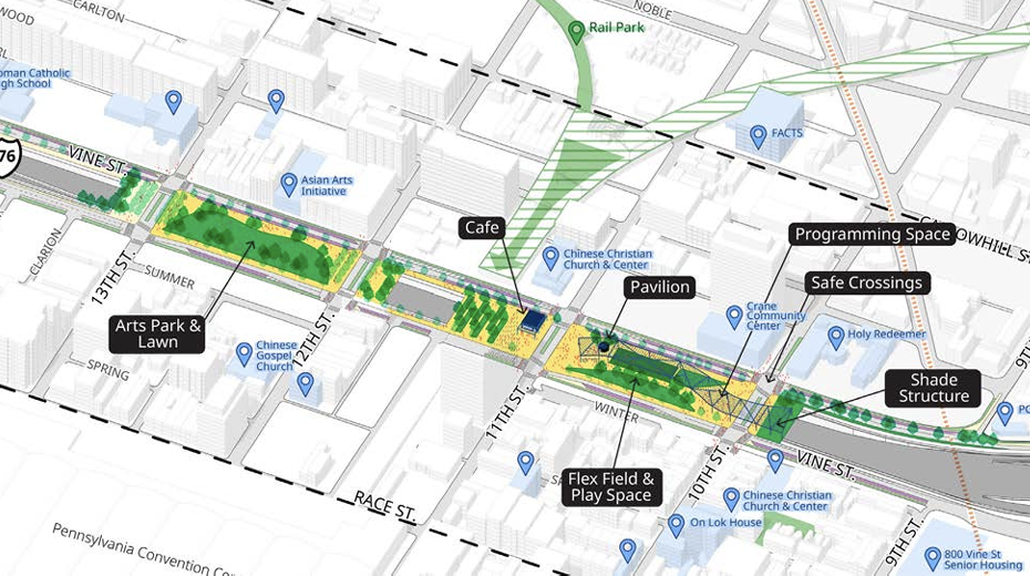
Under the leadership of Philadelphia's Office of Transportation and Infrastructure Systems (OTIS), this project seeks to reconnect Chinatown by building a cap over the Vine Street Expressway (I-676) between 10th and 13th streets.

Project Goals (taken directly from April 2025 newsletter)

  • Create an inviting public green space with trees and plants
  • Create a safe street design that extends the Chinatown neighborhood feel
  • Prioritize the needs of the elderly, young, and those with disabilities
  • Include public buildings and businesses that serve community needs

Collaborators and Partners

Chinatown Stitch Construction Timeline

2023
Engagement and brainstorming

2024
Initial data collection, analysis and engineering

2025
Refining the Concept in community. Look out for pop-up events to stay involved!

2026
Design Finalization

2027
Phase I construction begins

2030
Phase I construction expected to finish

**All photos were taken from the OTIS Chinatown Stitch Reports and Newsletters.

Klyde Warren Park

Dallas, TX

This project connected the predominantly Black Uptown neighborhood with the arts district and Downtown while also providing a community gathering space with free programming year-round. Since its opening in 2012, the park has enhanced the land value in the surrounding area, creating a positive economic impact on the City of Dallas including faster office and multifamily construction growth. However, it brought up concerns of “green gentrification” which benefits the interests of developers over displaced communities.

Image of Klyde Warren Park
Photo from klydewarrenpark.org

Completion date:
2013

Area Covered:
5.4 acres (235,000 sqft)

Cost:
$112 million

Type of project:
Park/Open Space

Cap at Union Station

Columbus, OH

The project addressed the 40-year scar that was created by the construction of the inner-belt highway (I-670) by reconnecting the Columbus downtown area and the Short North neighborhood. The cap acts as a bridge for through traffic across I-670 while also providing leasable spaces to many retail shops and restaurants, ultimately providing an inviting urban streetscape.

Image of Cap at Union Station
Photo from crexi.com

Completion date:
Completion date: 2004

Area Covered:
Area Covered: 25,500 sqft

Cost:
Cost: $7.8 million

Type of project:
Type of project: Commercial

The Big Dig at the Central Artery

Boston, MA

Creating more than 300 acres of open land with over 45 parks and public plazas, the Big Dig project replaced the deteriorating I-93 (Central Artery) with an underground expressway that links downtown Boston to the Boston Logan airport. This project also improved the North End and Waterfront neighborhoods' access to downtown Boston and reduced traffic congestion, providing ~$168 million per year in time and cost savings.

Image of The Big Dig at the Central Artery
Photo from themindcircle.com

Completion date:
2007

Area Covered:
2,350 acres

Cost:
$14.8 billion

Type of project:
Mixed Use

3. Our Prediction Model

We trained a model that incorporates many features of properties (internal characteristics like number of bedrooms, amenities like distance to City Hall, and location like neighborhood names) to predict property prices using the following formula:

Price = Internal Characteristics + Amenities + Location

bed icon air conditioner icon heater icon highway icon park icon train icon neighborhood icon


**Please refer to our markdown for more detailed information on our data analysis and modeling process.

Click "Next" to explore how we predict property prices to change as a result of the Chinatown Stitch!

NEXT